Friday Fave: Public Workout Maps
When I first found out about GIS, the first application that came to mind was using it to map my running routes. At that time, I was using paper maps and scraps of paper to measure how far I was running each day. GIS obviously offered a better method.
Almost twenty years later, GPS has become so common place that I think we have four or five devices in our household that have GPS capabilities and measuring my runs has become ridiculously simple.
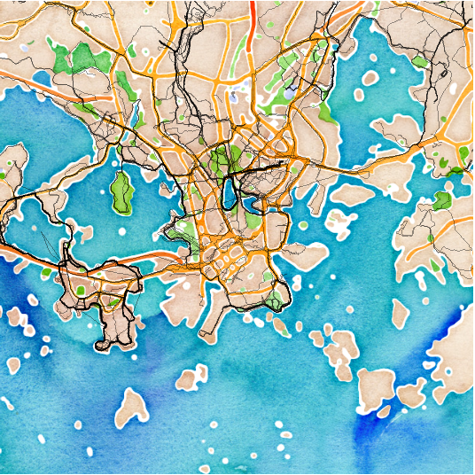
Given that background, you can understand why I love projects like this project by Nikita Barsukov, who compiled publicly available data from Endomondo and created maps of public running workout tracks for a variety of European Cities, including this sample from Helsinki.
Flowing Data, using a similar concept, generated similar maps for several cities in the United States, including Minneapolis–some areas I know.

I’ve got about six years of running data of my own that I should use to generate a personal running route map but would be a fun project.